

Position of the artefact with respect to the landslip.
With respect to landslip, the artefact can be placed in three positions (Figure 3): downstream of the unstable earth volume (a); on the unstable earth volume (b); upstream of the unstable earth volume (c). An artefact placed upstream of the unstable earth volume (a) is not without risk. Indeed a modification of the geo-lithological configuration downstream can lead to changes in the equilibrium configuration of the site in which the structure is built.
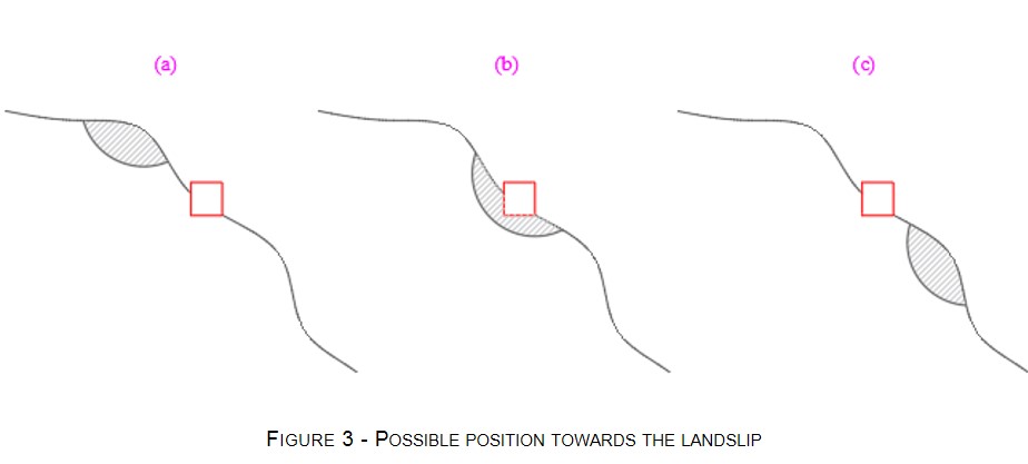
In the case of a construction placed upon the unstable volume (b) there may be a partial or a total failure. In case of site placed downstream of the landslide systems (c) it may occur that this is partially or totally hit from the debris flows. Referring to an historic masonry building, the following damages scenarios can occur:
- • Cracking;
- • Loss of equilibrium;
- • Modification of the original configuration or shape modification;
- • Partial or total structural collapse;
- • (other scenarios...)
The identification of the signals that can be correlated to possible damage scenarios is of relevant interest. Indeed, several kinds of crack patterns can be related to the settlements and can be a precursor indicator of subsidence and of the related to the landslide risk.
For this purpose, interpretative models of crack patterns provide useful information. One of this is the strut and tie model (Palmisano, 2014). This allows referring possible crack scenarios to the cause that generated it.
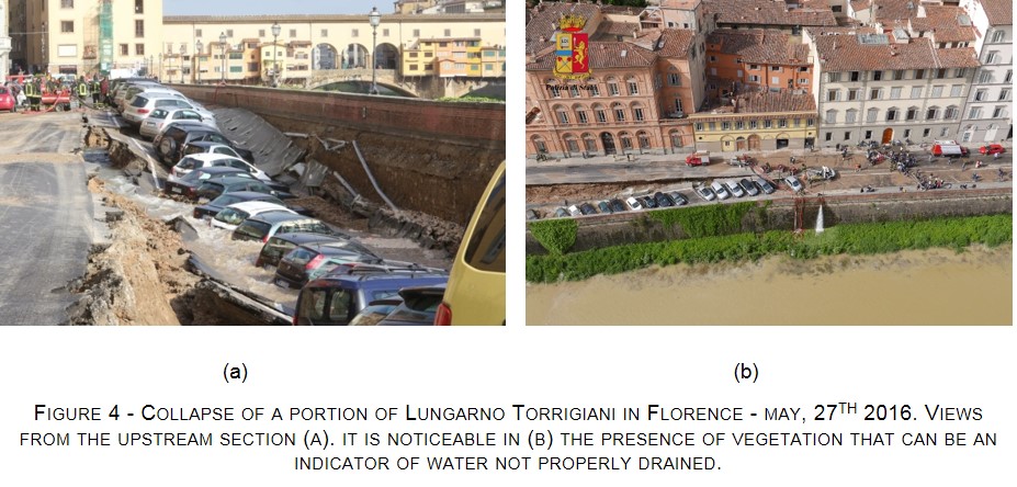
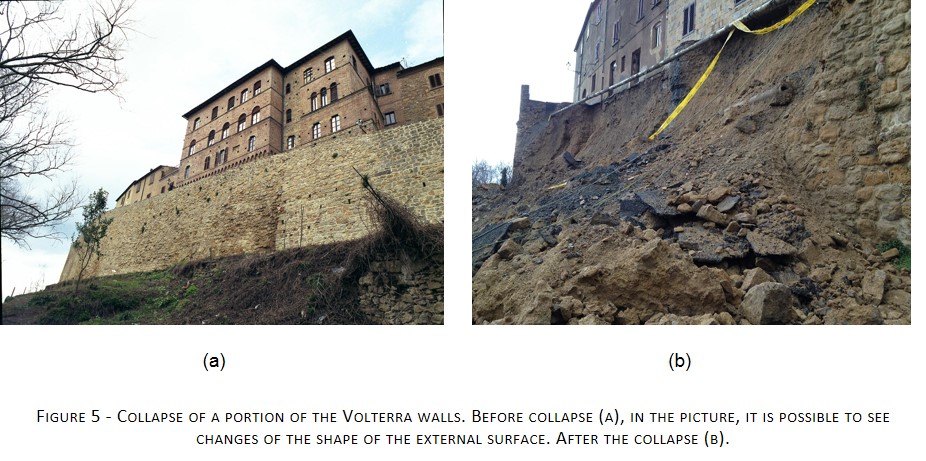
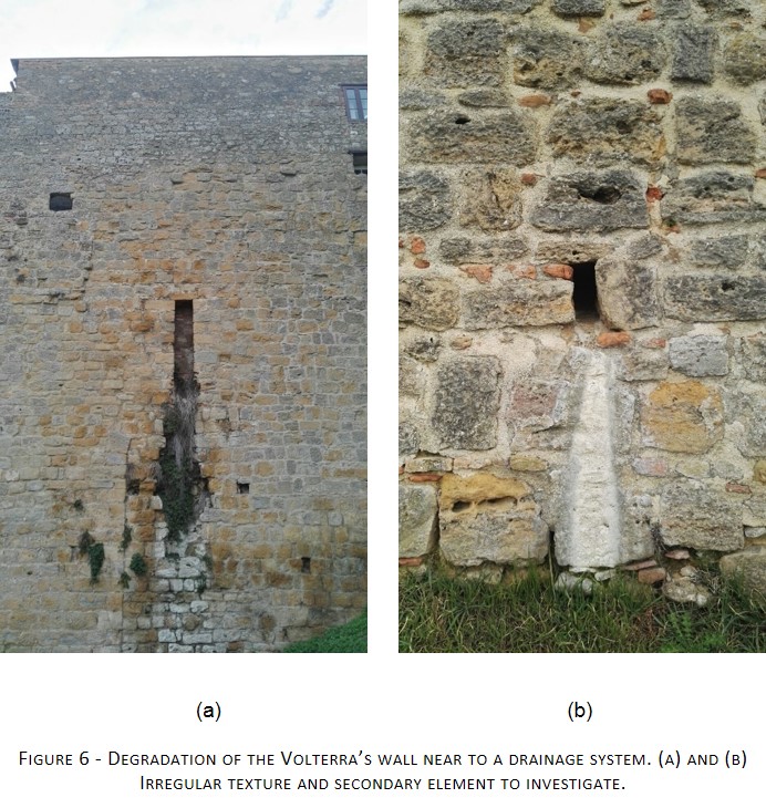
Others element may be indicators of instability phenomena, one of these is the presence of moisture or shape variation (Figure 4). The growth of vegetation on supporting structures, the irregularity of texture and irregular geometrical configurations or displacements on overhead (Figure 4 Figure 5 Figure 6) may be important indicators of a risk situation. Visual inspections can be useful for a preliminary assessment of the areas worthy to be further investigated.
The identification of possible “monitoring points” and its tracking throughout an electronic system can reveal important information on the prevision of landslides together with the cited indicators of intensity and extension of the rainfalls.