


Hydraulics
The movement of floodwaters through the landscape can be approximated using many different methods. Describing natural physical phenomena using numerical methods requires making broad assumptions to develop governing equations. While simple hydraulic modeling methods may be sufficient for approximating propagation of flood peaks through river channels, more complex hydraulic analyses may be necessary to incorporate effects of infrastructure or complex overland flow in urban areas (Syme et al. 2004; Syme 2008). Advanced models are capable of modeling more detailed physical phenomena, but this does not correspond to a decrease in uncertainty.
Hydraulic models rely on topographic data for a consistent geometric representation of the study domain. The recent increased availability of high-resolution topographic data, thanks to LiDAR surveys (Yan et al. 2015; Cobby et al. 2001; Correia & Rego 1998), allows increasing the spatial resolution of the computational mesh, which is generally required for heterogeneous areas such as dense urban settlements. Moreover, remote sensing and satellite images help in many cases to define flow parameters (e.g. roughness). The large use of different kind of territory data has led to a primary role of Geographic Information System for a better data management before and after hydraulic simulations (Zerger & Wealands 2004; Deckers et al. 2010; Samarasinghe et al. 2010).
The most widely used approach to modeling fluvial hydraulics has been 1D finite difference solutions of the full de Saint-Venant Equations (Horritt & Bates 2002; Gilles & Moore 2010; Finaud-Guyot et al. 2011; Helmiö 2002).
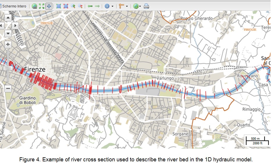
At the regional scale, river hydraulics is usually simulated with a mono-dimensional approximation. In fact, the hydrodynamic approach is a compromise between accuracy and computational load and large areas usually require simpler approaches. In 1D approach the river reaches are described using cross sections representing the key morphological and altimetry features of the stream, an example is shown in Fig. 4 for the urban reach of the Arno river in the city of Florence.
At the regional scale, floodplain hydraulics can be either simulated with a 1D approach using extended cross sections or using systems of interconnected storage areas (Arrighi et al., 2013).